Trail Walking La Salle-les-Alpes - Grand AREA 21/06/18 - Photo
 R@ph
R@ph

User GUIDE

© OpenStreetMap contributors
Length
Length
9.4 km
Max alt
Max alt
2850 m
Uphill gradient
Uphill gradient
688 m
Km-Effort
Km-Effort  
18.5 km
Min alt
Min alt
2157 m
Downhill gradient
Downhill gradient
672 m
Boucle
Boucle
Yes
Creation date :
2018-06-23 14:04:23.251
Updated on :
2018-06-23 14:20:32.472

(0 Reviews)

Walking
Walking
3h41
Difficulty : Difficult

Scan this QR Code to open this trail in the SityTrail application

FREE GPS app for hiking

Logo SityTrail SityTrail

IGN / Geographical institutes

Download SityTrail from the App Store Download SityTrail from Google Play

Logo SityTrail SityTrail World

The world is yours!

Download SityTrail from the App Store Download SityTrail from Google Play Download SityTrail on Huawei AppGallery

About

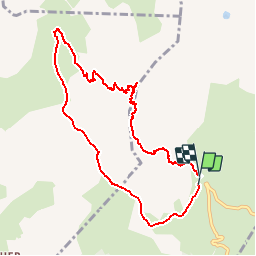
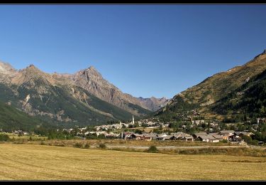
Trail Walking of 9.4 km to be discovered at Provence-Alpes-Côte d'Azur, Hautes-Alpes, La Salle-les-Alpes. This trail is proposed by R@ph.

Description

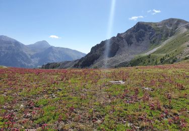
Une boucle d'un peu plus de 9 kms au départ de la bergerie St Joseph ( dernière épingle avant le sommet du Granon) avec un passage par le col de Buffère.
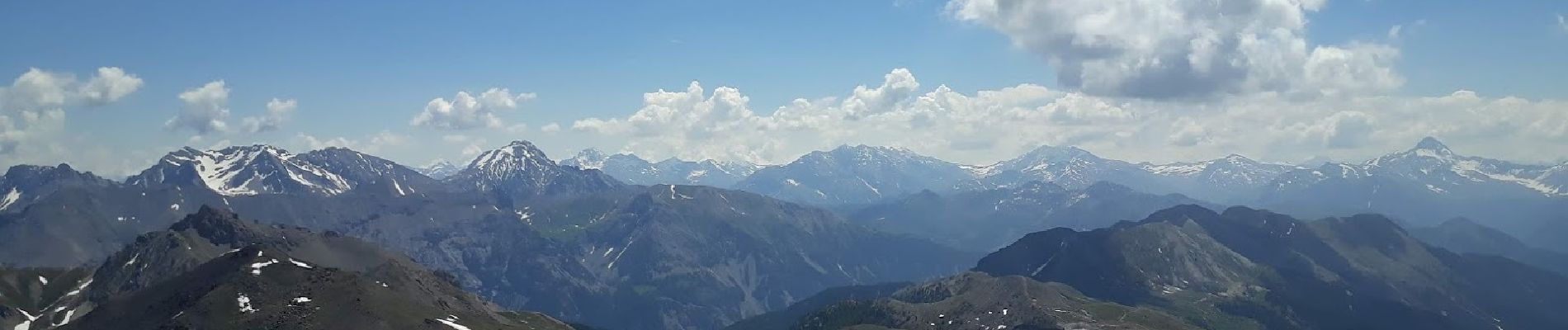
La randonnée vous conduira au sommet du Grand Area à 2868 m avec un panorama magnifique.
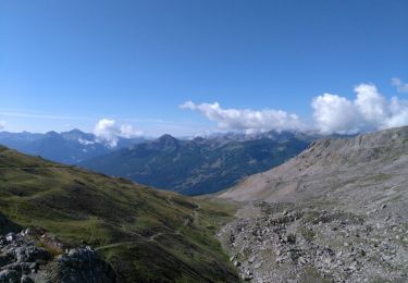
Pour la descente nous avons plus ou moins coupé droit dans le pentu et profité de belles glissades sur les névés encore présent en toute sécurité bien sur sur !

Elevation profile

Photos

Positioning

Country:
France
Region :
Provence-Alpes-Côte d'Azur
Department/Province :
Hautes-Alpes
Municipality :
La Salle-les-Alpes
Location:
Unknown
Start:(UTM)
309440 ; 4982213 (32T) N.

Trails nearby

Trail Walking La Salle-les-Alpes - le grand Aréa (boucle) - Photo
Walking
GUIDE
amiral13

Walking

Medium
La Salle-les-Alpes, Provence-Alpes-Côte d'Azur, Hautes-Alpes, France
7.7 km | 17.1 km-effort
4h 49min
Yes
Trail Mountain bike Saint-Chaffrey - granons tronchet - Photo
Mountain bike
Vincentetourmy

Mountain bike

Difficult
(1)
Saint-Chaffrey, Provence-Alpes-Côte d'Azur, Hautes-Alpes, France
15.5 km | 24 km-effort
1h 52min
No
Trail Walking Le Monêtier-les-Bains - tour de la cucumelle  - Photo
Walking
tchoua

Walking

Medium
Le Monêtier-les-Bains, Provence-Alpes-Côte d'Azur, Hautes-Alpes, France
21 km | 38 km-effort
5h 5min
Yes
Trail Walking Le Monêtier-les-Bains - Les Boussardes - Photo
Walking
LANDRIEU

Walking

Easy
Le Monêtier-les-Bains, Provence-Alpes-Côte d'Azur, Hautes-Alpes, France
15.7 km | 19.2 km-effort
5h 1min
No
Trail Walking Saint-Chaffrey - col du granon-croix de la cime - Photo
Walking
RayFab

Walking

Medium
Saint-Chaffrey, Provence-Alpes-Côte d'Azur, Hautes-Alpes, France
6.5 km | 10.7 km-effort
1h 59min
Yes
Trail Walking Le Monêtier-les-Bains - Grand Aréa - Photo
Walking
flip38

Walking

Difficult
Le Monêtier-les-Bains, Provence-Alpes-Côte d'Azur, Hautes-Alpes, France
25 km | 46 km-effort
8h 1min
Yes
Trail Walking Saint-Chaffrey - les crêtes de Peyrolles - Photo
Walking
GUIDE
amiral13

Walking

Easy
Saint-Chaffrey, Provence-Alpes-Côte d'Azur, Hautes-Alpes, France
13 km | 21 km-effort
5h 20min
Yes
Trail Walking Névache - RA 2019 Tour du Mont Thabor J2 - Photo
Walking
dfluzin

Walking

Medium
Névache, Provence-Alpes-Côte d'Azur, Hautes-Alpes, France
12.3 km | 22 km-effort
5h 11min
No
Trail Walking La Salle-les-Alpes - lac de Chrytolet et lac rond du Chrystolet - Photo
Walking
gfk49

Walking

Medium
La Salle-les-Alpes, Provence-Alpes-Côte d'Azur, Hautes-Alpes, France
8.4 km | 15.5 km-effort
3h 42min
Yes


Close
My subscriptions